| 2024/10/28 (Monday): 2-5 PM Short course (S135, Dept. Earth Sciences, NCU) Plate Flexure, Isostasy and Earth's Gravity Field |
|
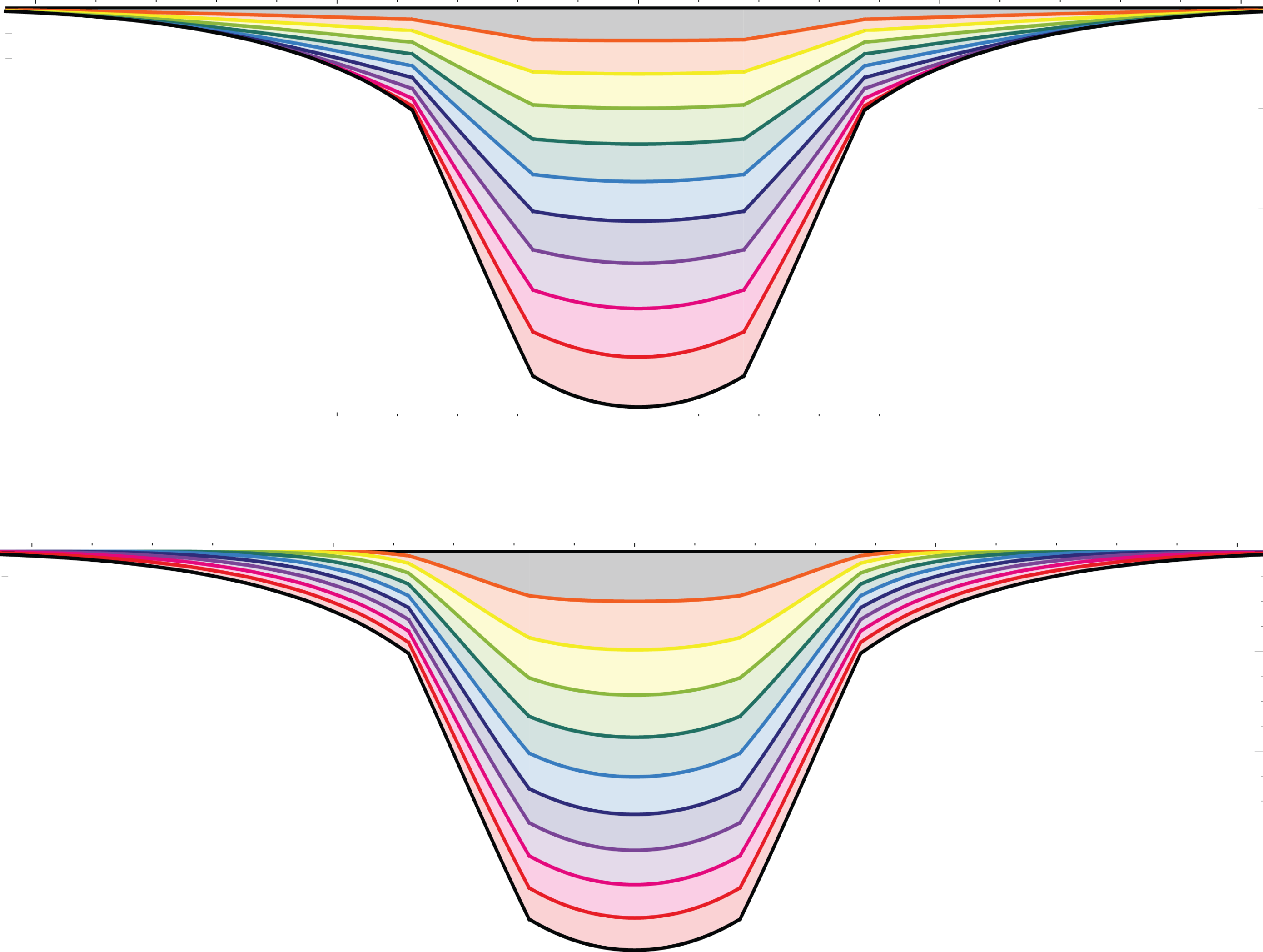
| The aim of this short course is to explore the phenomenon of plate flexure and how it has impacted our understanding of the geological record, the rheological properties of Earth’s tectonic plates, and the geoid and gravity field. In Part 1, we will discuss the historical development and the theory that underlies plate flexure and give examples of some of the loads that drive flexure at ocean islands and seamounts, large river deltas, and deep-sea trenches and outer rises. In Part 2, we will discuss how the lithosphere responds to loading on short-term (i.e. > tens of years) seismic to long-term (i.e. > 1 Ma) geologic time-scales and give examples of how observations of flexure have been used to infer the relationship between the plate rigidity and age, constrain brittle and ductile flow laws derived from experimental rock mechanics data, and estimate the rate at which isostatic adjustment takes place in different tectonic settings. Finally, in Part 3 we will examine the relative contribution of plate flexure and mantle dynamics in contributing to Earth’s gravity and topography fields. We will show that the long wavelength gravity field (i.e. wavelength > ~1000 km) cannot be attributed to plate flexure and is most likely caused instead by some form of mantle dynamics and that stratigraphic data (e.g. through global mapping of hiatuses, pinch-outs, onlap and offlap patterns) offers the most potential to isolate the magnitude of any dynamically driven topography. | 報名網址: |
| 2024/10/29 (Tuesday): 2-3 PM Lecture (Institute of Earth Sciences, Academia Sinica) Plate Flexure and the Origin of Sedimentary Basins |
|
| Plate flexure is a universal phenomenon that describes how planetary lithospheres responds to large loads imposed on their surface such as those associated with glaciation/deglaciation, volcanism and sedimentation. Backstripping of well data reveals that sediment loading, for example, contributes significantly to the formation of rift-type basins, amplifying the subsidence caused by stretching, heating and thinning of the lithosphere during rifting by up to a factor of 2.5. The actual response depends, however, on knowing the sediment thickness at the time of deposition, the paleobathymetry, the sea level and, importantly, the thermal and mechanical properties of the underlying lithosphere. Simple models of progradation and aggradation show that sediment-driven plate flexure contributes to the stratigraphic ‘architecture’ of sedimentary basins, including patterns of onlap and offlap. In addition, process-oriented gravity and flexure modeling of sedimentary basins shows that the effective elastic thickness, a proxy for the long-term strength of the lithosphere, increases with age since rifting and is given approximately by the depth to the 450°C isotherm based on cooling plate models. Arguably the best examples of flexure are foreland-type basins that form in front of migrating thrust/fold loads. Simple models show that flexure produces a wedge-shape depression and a flanking bulge and controls the depth and width of the depression and drainage patterns in bulge regions. The lithosphere retains a ‘memory’ of past loading events, which allows sedimentary basins to morph from rift-type to foreland-type and for the strength of the lithosphere acquired in one event to be inherited by a future event. Flexure likely plays a significant role in the development of cratonic-type basins although their association with thick seismic lithosphere, long-lived stratigraphic sequences, little or no rifting and a deep-sourced gravity anomaly make it difficult to resolve. |
 |
| 2024/10/31 (Thursday): 4-5 PM Lecture (S135, Dept. Earth Sciences, NCU) Mountains in the Sea |
|
| One of the mysteries of the sea are the large number of seamounts that rise on the seabed and, in a few cases, break surface to form oceanic islands. Volcanic in origin, seamounts are widely scattered throughout the world’s ocean basins, especially in the Pacific. Recent estimates suggest that there maybe as many as 200,000 seamounts with heights that range from 0.1 to 6.7 km above the surrounding seafloor. Seamounts are generally circular in shape, have pointed, star-shaped, curved, or flat tops, and are often capped by a coral reef. They are of geological interest because they record the motions and the mechanics of Earth’s tectonic plates and the magmatic ‘pulse’ of its deep interior. They are also significant as ocean ‘stirring rods’, biodiversity ‘hotspots’, and hazards for earthquakes and tsunamis, submarine landslides, and navigation. Statistical studies suggest that there are as many as 24,000 seamounts higher than 1 km still to be discovered. The charting of these seamounts and the determination of their morphology, structure, and evolution is one of the many challenges facing marine geologists in the future. |
 |