Meetings/Workshops co-organized by this group
Prof. Watts Lectures in Taiwan (28-31 October, 2024)
2024 淨零減碳 親子生活營 (27-28 July, 2024)
2020 桃園海岸服務隊與研討會 (24-26 August, 2020) The 7th Taiwan Stratigraphy Symposium, homepage (26 December, 2019)
The 7th Taiwan Stratigraphy Symposium, Field Trip (27 December, 2019)
WPSM (19-20 March, 2018)
Workshop on Processes and Products of Deep-Sea Sediment Gravity Flows(深海沉積討論會)(August, 2017)
Taiwan-Japan Deep Drilling Science Symposium (Feb, 2016)
EAGER Workshop (Extreme events Archived in GEological Records) (November, 2013)
Welcome to Basin Research Group of Department of Earth Sciences, National Central University. We are a group of people who study sedimentary basins. A sedimentary basin is an area where long-term basement subsidence and sediment deposition occur. Study of sedimentary rocks may reveal the earth history, including paleoenvironments, regional plate tectonics, paleoclimate, and the evolution of life.
Analysis of sedimentary basins holds many exciting research opportunities such as the origin and destruction of basins/mountain belts, interactions between the earth's crust, biosphere, ocean, and atmosphere. Sedimentary rocks are the hosts for many economic deposits (e.g., hydrocarbons, coals) and ground waters. The study of sedimentary rocks has therefore many aspects of applications which may include hydrocarbon exploration, coal and mineral mining, hydrogeology, and geo-sequestration of carbon dioxide. We apply various methodologies in basin analysis such as field geological mapping, outcrop/core sedimentary facies analysis, wireline-log analysis, reflection seismology, and gravity modelling.
Main commercial software used in this group include: ProMax (for seismic data processing), Petrel (for seismic data interpretation), Interactive Petrophysics (for wire-line log data interpretation), Rivertools (for topographic data analysis).
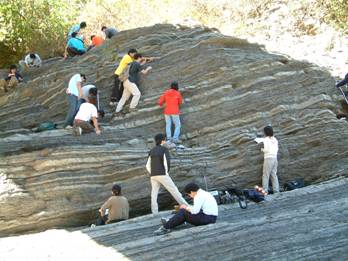 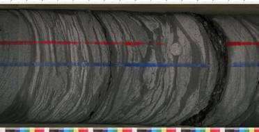
Stratigraphic studies carried out either on outcrops (left) or on cores retrieved from subsurface (right) are two example approaches for basin analysis.
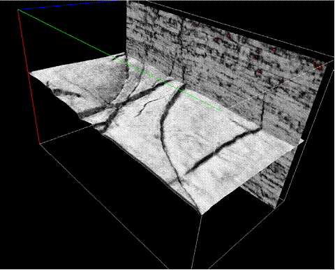
A 3D seismic cube shown with variance attribute and a structural surface textured with variance attribute map using Petrel software. Note that fault traces are clearly demonstrated in this structural surface. Petrel is one of the software package employed in this research group for seismic interpretation.
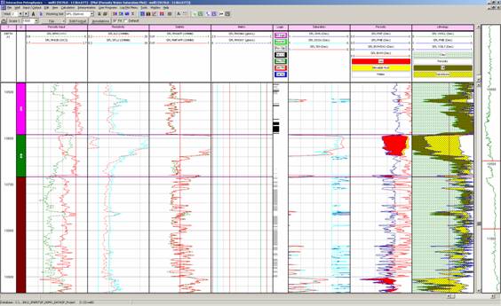
An example wire-line log analysis for hydrocarbon exploration using software of Iterative Petrophysics (IP). Our group uses IP software package to analyze wire-line log data.
|

